Rothberg-Birdwhistel Expedition Fund: Panchachuli III Peak Climb
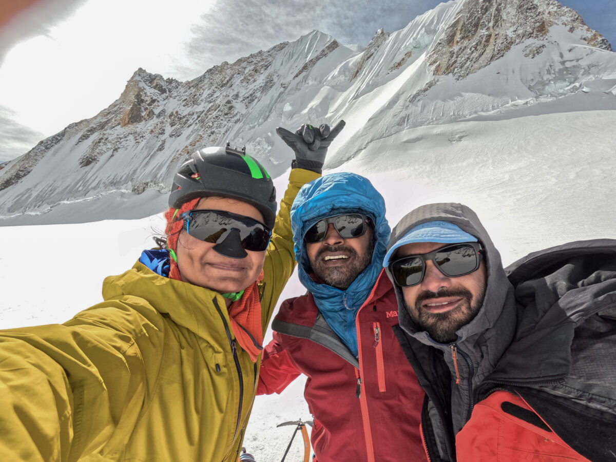
In May 2025, Bharat Bhushan, Prerna Dangi, and I took on a challenge to climb Panchachuli III (6,349m), believed by local residents to remain unclimbed. We aimed to approach it via the northeast route through the Meola Glacier. Despite occasional visits by military and paramilitary personnel, there was no recorded mountaineering information or documented route available. Mountaineering in the Indian Himalayas is rarely attempted due to bureaucracy, difficult access, and the unforgiving terrain—marked by hanging glaciers, loose rock, steep slopes, and high altitude. Our team chose to climb in alpine style—without high-altitude porters or fixed camps—going against the usual expedition approach often seen in this region.
We all met in July 2024, when the idea of taking on the challenge of climbing an unclimbed peak in India first came up. In July 2024 we all met, and the idea of challenging ourselves by attempting to climb an unclimbed peak arose. Our original plan was to attempt Dangthal; that went down the drain after we were unsuccessful in convincing the Indian government to open access to the banned peak. After a lot of planning and rethinking, we decided to take on the challenge of climbing Panchachuli III.
Start of the Expedition
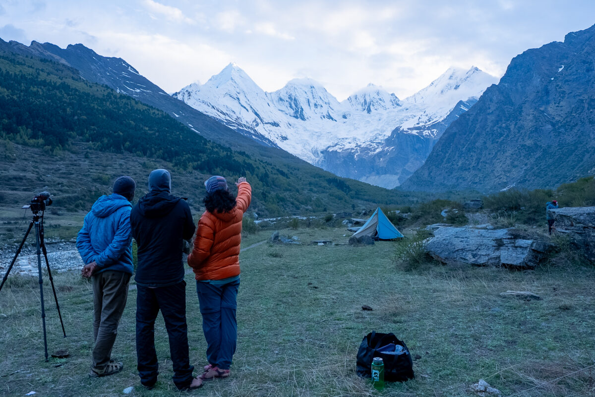
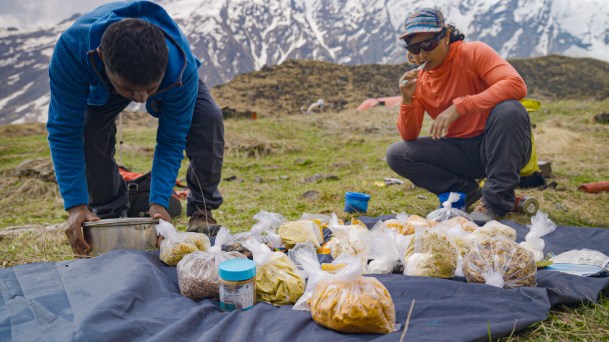
On May 12, we all met in Dharchula. After unsuccessful efforts to arrange porters, we drove to Dugtu village (3,200m) and camped for the night. The drive to Dugtu was breathtaking. Dugtu itself was a small Himalayan village with the view of Panchachuli range in the backdrop; we collectively agreed it was the best view ever! The next day, we started hiking at around 8 am and established Base Camp at around 3,650m (12,000 ft). Mule support helped us with the initial flat approach, but after crossing a drainage, we had to carry our own loads up the steep moraine to reach our camp. We had to do two rounds of load ferrying up the steep moraine and grassy section, and encountered some loose rocky terrain.
Advanced Base Camp
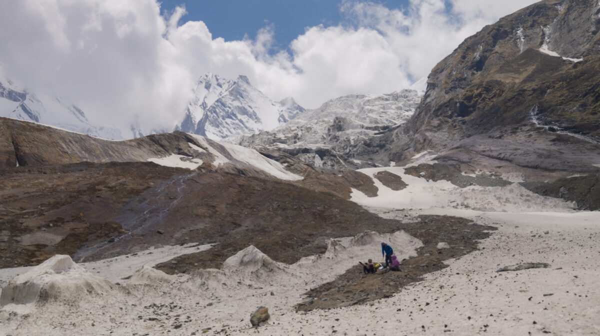
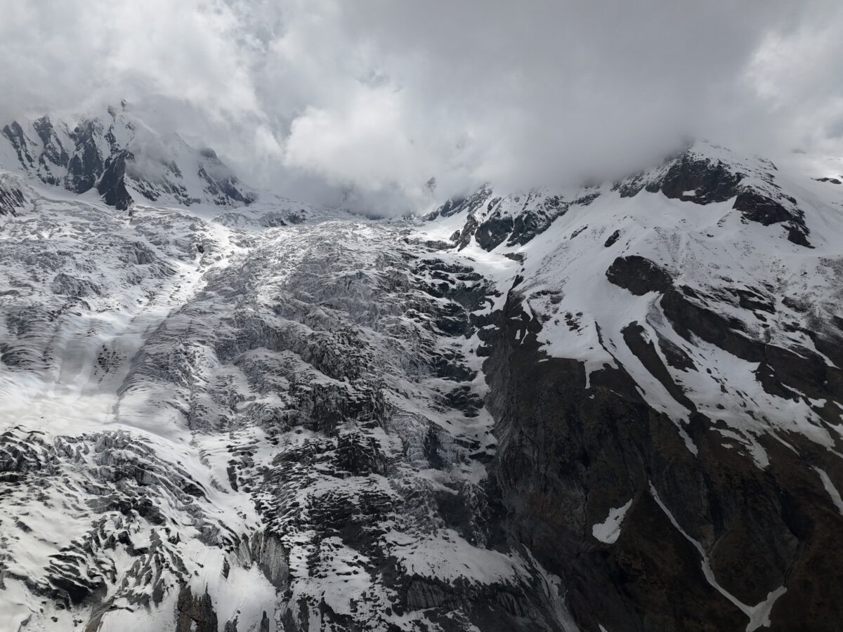
A reconnaissance and load ferry helped us identify a glacier access point at 4420m (14,500 ft), reached via steep grassy slopes, moraine, and snow. We were able to fly a drone near the glacier’s access point to check out the terrain as much as possible.Unfortunately, we couldn’t get anywhere close to the ridge that we had planned to ascend to reach the summit. We really enjoyed the hike for this load ferry, it was really exciting to get the first close up look of the Meola glacier(we had only seen it previously on Gaia and Google Earth. There was lots of joking around and pulling each other’s leg on the trail as we always go whenever the three of us are together. The following day, we moved to Advanced Base Camp. Using drone scouting, we planned a route along the steep eastern ridge of Panchachuli 2, where the glacier appeared more uniform and less hazardous, with fewer seracs and icefall features.

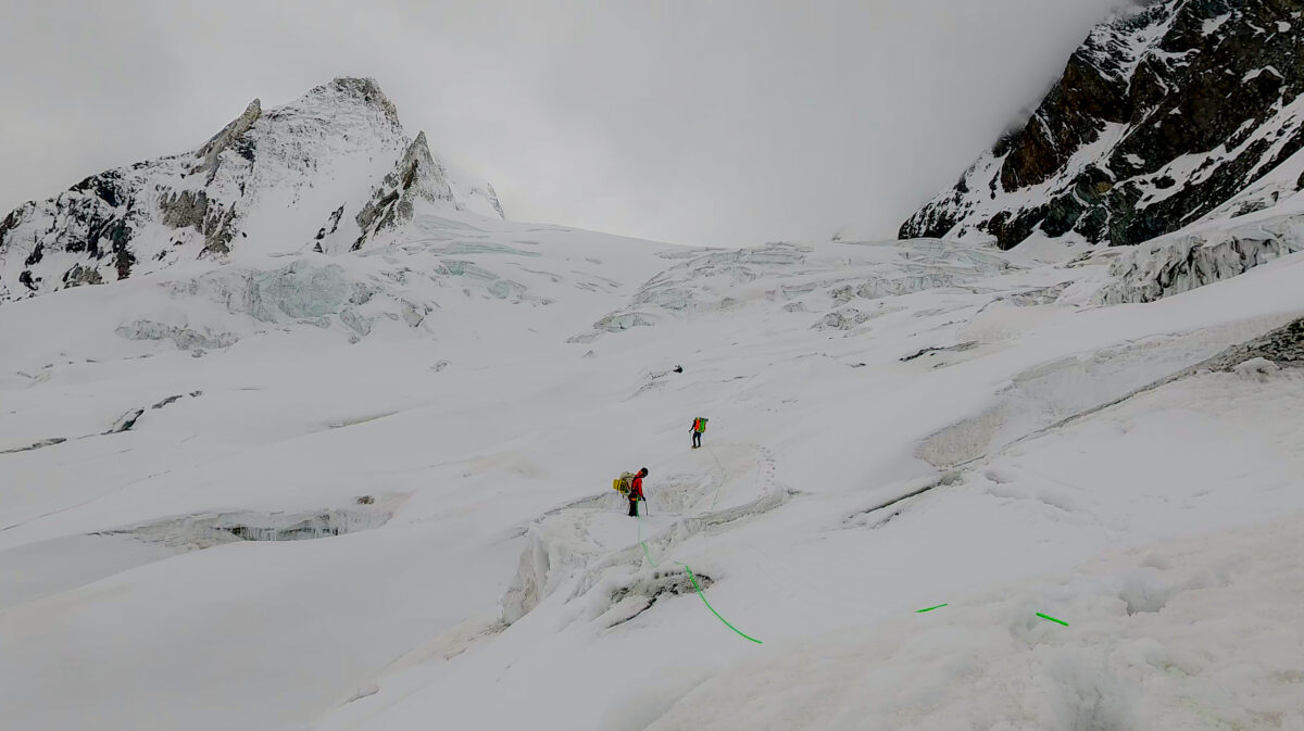
Glacier Ascent
We set off early from ABC, following the planned line for the most part. Based on favorable snow conditions, manageable glacial terrain, and our confidence, we chose not to rope up. A technical ice section had to be soloed using ice axes due to steep, uneven terrain and rockfall exposure. Additionally, we had to manage a lot of loose rocky terrain. Bharat had a close call with some loose rock speeding towards him, thankfully he was able to quickly respond and jumped to get out of the way. We gained approximately 800m (~2600 ft) and established High Camp at around 5200m, but we stopped due to worsening weather and physical exhaustion. The next day was a layover day as we were tired from last days’ ascent and we decided that we should take some time to rest and recover. The layover was however too hot to be inside or outside the tent and some gusts of cold breeze during the day were such a relief.
Towards the Col
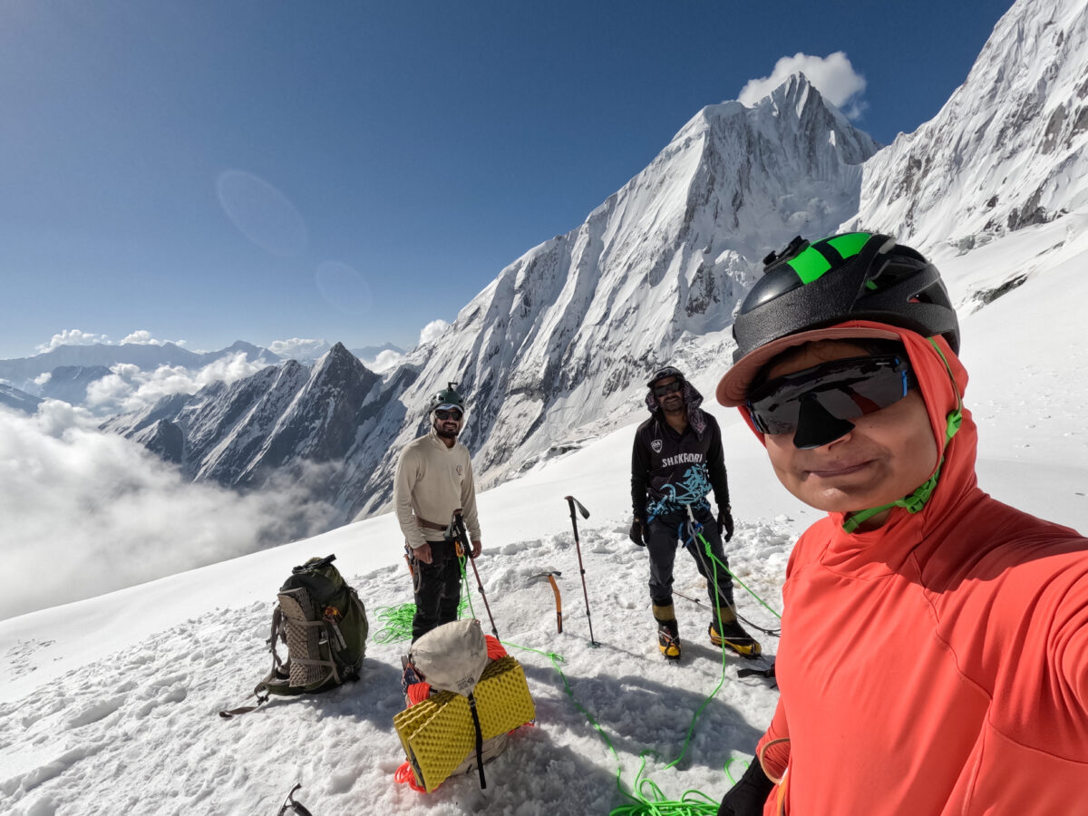
After resting on the previous layover day, we resumed glacier travel with lightened loads, carrying only essential items. This time, we roped up due to steeper and more broken terrain than on earlier days. Early in our ascent we encountered a very featured ice wall and had to find a safe and less steep section to cross it. We gained around 2000 ft and established Summit Camp on a bench below the col between Panchachuli II and III. Altitude fatigue made progress slow. Kicking steps was gruelling, and we had to switch leads frequently within the rope team to manage the effort. That evening we were camping on a tiny ridge and it got very gusty (it was really scary!). As soon as we found a window, we quickly moved our tent to a bowl about 20 feet below the ridge.

Summit Push & Retreat
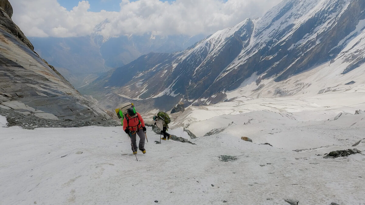
We took another layover day to recover, as signs of altitude fatigue had become evident. Another really hot day of staying inside the tent. After the second rest day, we began our summit push early. We were forced to retreat within an hour due to fatigue, an old injury, and deteriorating weather signs. The terrain ahead—steep and technical—would have required more strength and time than we could safely commit. We descended all the way to Base Camp, rappelling one glacier section due to unsafe downclimbing conditions caused by melting snow and exposed rock. Although the feeling of not being able to make it to the summit was tough to swallow, we were excited for hot non-freeze dried food and a lot more oxygen at the base camp.
Reflection and learnings
One of the biggest takeaways was that real recovery stops around 5,000 meters—above that, rest days don’t do much. It’s crucial to take breaks before you’re deep into altitude. We also realized how different the mountain looks in person compared to the maps. Terrain that seemed manageable on Gaia or Google Earth often turned out to be far more technical, looser, or exposed than anticipated.
During the ascent, fatigue from multiple days at altitude, lingering injuries, and the mental strain of the environment started to wear us down. The initial stoke that had fueled the expedition was fading, and motivation became harder for us to access. That shift in motivation/energy deepened when we realized the “snow ridge” we’d planned to ascend didn’t actually exist. Instead, we were faced with sheer ice, corniced ridgelines, and exposed mixed rock climbing—terrain far more technical and serious than we expected. That moment of realization changed the mood. It also began to shape how we interacted as a team. Throughout the expedition, the unexpected challenges of the terrain/expedition, began to shape how we interacted as a team. Compared to a previous trip some of us had done together, the dynamic felt different—less connected, less fluid. It wasn’t about conflict, just a quiet sense that we weren’t quite in sync.
After all our setbacks, we felt genuinely proud of what we accomplished. Sleeping at 5,800m and reaching a high point of 5,900m was a major physical and mental milestone—especially while navigating mixed terrain of glacier, ice, snow, and moraine. Creating and moving through a new, exposed route gave us a real sense of exploration and originality. It felt deeply fulfilling to take on a challenge in one of the most remote, unforgiving, and technically demanding mountain environments—where few people even consider going—and to return safely. And the views throughout our journey were awe inspiring!
Topics: NOLS Instructors